As I mentioned in my previous post, Burnt Bridge the settlement, first appeared in the newspapers of the day in 1852 and by 1853 John Morrison was replacing his original inn on the old track from Geelong, with a new, larger building facing the new road alignment.
At around this time, on the 22nd January, 1853 the Geelong Advertiser and Intelligencer reproduced a description of a journey from Geelong to the Ballarat gold fields, given by a Mr Bonwick. This was that gentleman's description of the land surrounding Burnt Bridge:
No surface rock appeared for miles. The verdure was good. One mile from the blue flag [of a previous coffee tent] rose the Burnt Bridge Coffee Tent. A fine running stream, gentle rises, plenty of grass, and a white-gum forest, give considerable attractions to this quarter.The stream in question was most likely Williamson's Creek or a branch a little to the south known as Salt Creek. Williamson's Creek is a tributary of the Leigh River. It rises to the south of the present Midland Highway, about 2.5 km south east of the town of Scotsburn and forms part of a network of creeks and gullies draining the rather swampy land which lies beneath Mt Buninyong before emptying into the Yarrowee River around 2 km north of the Leigh Grand Junction Bridge. It is at this point that the name of the river changes to the Leigh River.
Back at Burnt Bridge, an 1855 survey map shows a short section of the old track crossing Salt Creek via a bridge, but does not extend to show the Williamson's Creek crossing which must also have been necessary. It does not show the site of the original "burnt bridge" and from this point, I have a gap in the paper trail until the track reaches the site of today's Clarendon township.
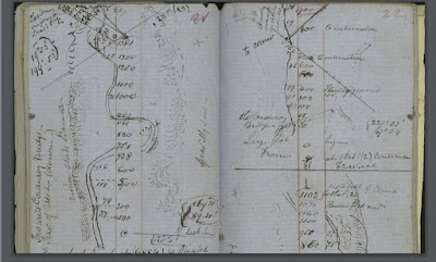
Whilst the survey books for the land including and immediately surrounding the town are available, they are currently beyond my capacity to interpret as surveyor Eugene Bellairs was not as ordered in his note-taking as some other surveyors. More importantly perhaps, his points of reference are not as clear as others, making it hard to follow his lines.
 |
| A page from E Bellairs field book, 1854. Books accessible via the Landata website |
The 1859 map shows a track marked as the "old track from Ballarat" south of the creek and running roughly parallel to its course past the future town site. The 1858 map does not show the track but marks a position on the creek as the site of the "original corduroy bridge" and this is where things get a little interesting.
Secondly, the "original Corduroy Bridge" does not appear to lie on the path of either the old road or the new, but instead crosses Williamson's Creek about 500 m north west of the current bridge and around 150 m north of the old track (see map below). Looking a little further. afield, an 1855 survey map of the parish of Buninyong shows the old track to Ballarat continuing roughly north westerly before meeting the current highway close to Scotsburn. At no point does the track appear to cross the creek again. In addition however, the map also shows a track which closely follows the path of today's Wiggin's Rd, travelling from the east side of Mt Buninyong to merge with the current route of the highway a little south of the current Wiggin's Rd intersection. The old and new then travel together towards Clarendon township, north of the creek.
 |
| The 1858 survey map overlaid on Google Earth. The red line indicates the "old track from Ballaarat" as plotted on the 1859 map |
Which brings us to the next point of interest: the name Corduroy Bridge. Originally this would not have been so much the name of a place as the description of a landmark - a simple rough-made style of bridge which was commonly constructed in rural areas to ford small creeks or cross swampy land. The technique involved strapping together logs placed in a transverse fashion across the creek or swampy ground to be crossed. The transverse logs were supported underneath, often by longer logs cut and placed at right angles to those above. Such bridges were cheap, quick and easy to build and were often used by military forces needing to erect a temporary crossing, even to relatively recent times, however they provided a very rough surface and could be difficult, even dangerous to cross - especially in wet weather.
 |
| An example of a corduroy bridge c1886. Image held by the National Library of Australia |
No comments:
Post a Comment